C-RTK 2HP Dual Antenna for Yaw RTK Module

  • Dual-antenna direction finding.
  • Centimeter-level positioning.
  • Multi-constellation multi-frequency receiver.
  • RM3100 industrial-grade magnetometer.

All-constellation Multi-frequency High-Precision Positioning

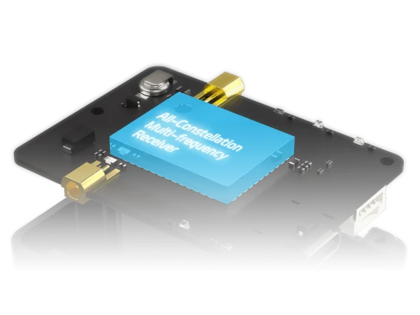
Built-in all-constellation multi-frequency satellite receiver, support BeiDou, Galieo,  GLONASS, GPS four satellite systems, and support four satellite systems at the same time receive, positioning accuracy plane 0.8cm+1ppm, elevation: 1.5cm+1ppm.

UAV DroneCAN RTK GNSS Receiver. 无人机 DroneCAN 全球卫星定位接收机. C-RTK 2HP
BeiDou
Galieo
GLONASS
GPS
UAV DroneCAN RTK GNSS Performance. 无人机 DroneCAN 全球卫星定位性能. C-RTK 2HP
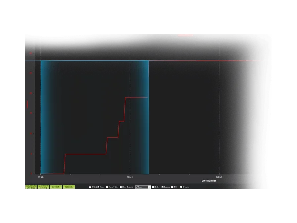
Convergence time is ≈ 18s
Number of satellites:28

Fast Positioning Without Waiting

Through the all-constellation multi-frequency GNSS signal and the advanced RTK algorithm, the convergence can be completed within 18s and the centimeter level positioning can be realized.

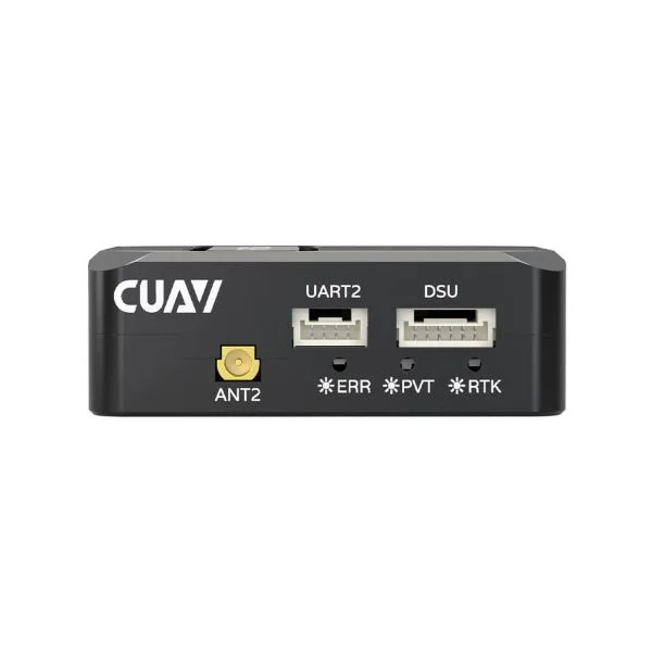
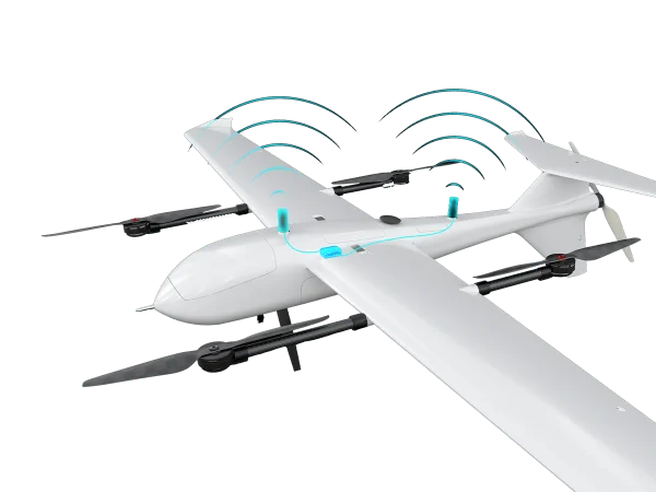
Single Module Dual Antenna for Yaw

The C-RTK 2HP supports one module, dual antenna to realize unmanned system estimate yaw, replacing the magnetic compass to achieve a more stable flight and adapt to complex environments at a lower cost.
UAV DroneCAN RTK GNSS Dual Antenna. 无人机 DroneCAN 全球卫星定位双天线定向. C-RTK 2HP
UAV DroneCAN RTK GNSS RM3100 Sensor. 无人机 DroneCAN 全球卫星定位 RM3100 磁罗盘磁力计. C-RTK 2HP

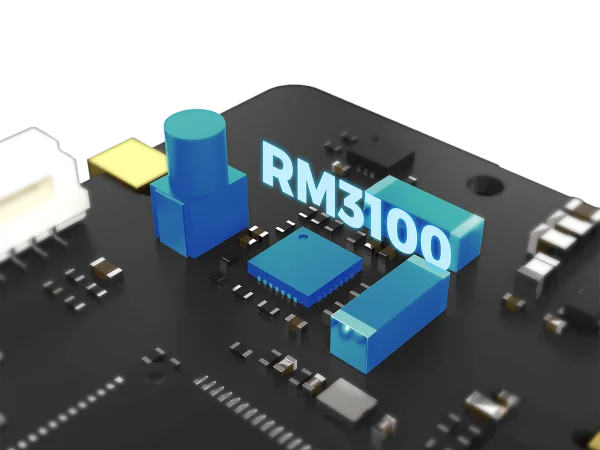
Built-in Industrial Grade RM3100 Compass

The C-RTK 2HP has an industrial-grade RM3100 compass that can be installed away from interference and can be used as a reliable redundant backup source.
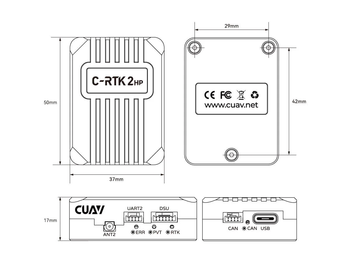
Specification

ProcessorSTM32F412 32bit Arm® Cortex®-M4 100MHz 512KB Flash 256KB RAM
MagRM3100
Number of Concurrent GNSS4
Antenna 1 (Main) GNSS BandBeiDou: B1I, B2I, B3I.
Galileo: E1, E5a, E5b.
GLONASS: L1, L2.
GPS: L1C/A, L2C.
QZSS: L1, L2, L5.
Antenna 2 GNSS BandBeiDou: B1I, B2I, B3I.
Galileo: E1, E5b.
GLONASS: L1, L2.
GPS: L1C/A, L2C, L5.
QZSS: L1, L3..
Position AccuracySingle Point: 1.5m (Horizontal), 2.5m (Vertical).
DGPS: 0.4m + 1ppm (Horizontal), 0.8m + 1ppm (Vertical).
RTK: 0.8cm + 1ppm (Horizontal), 1.5cm + 1ppm (Vertical).
Communication ProtocolDroneCAN, NMEA
Differential DataRTCM 3.x
PPK Supportnot supported
Navigation Update Rate5Hz Default (20Hz Max)
Support ControllerCUAV, Pixhawk etc.
Support FirmwareArdupilot, PX4
Operating Voltage4.7V ~ 5.2V
Operating Temperature-20℃ ~ 85℃
Dimensions50mm × 37mm × 17mm
Weight40g
接口CAN × 1.
Serial Port × 1.
DSU × 1.
USB (Type-C) × 1.
Antenna Port × 2.

Dimensions chart

UAV DroneCAN RTK GNSS Dimension. 无人机 DroneCAN 全球卫星定位尺寸. C-RTK 2HP

ArduPilot, Dronecode, and PX4 Long-Term Partners

CUAV Technology Co., Ltd. is a National High-Tech Enterprise and Guangdong Provincial Specialized, Sophisticated, Innovative SME that focuses on open-source unmanned system innovation technologies. It integrates R&D, production, sales, after-sales service, and technical support into a cohesive operation. The company maintains long-term collaborative partnerships with leading open-source organizations such as ArduPilot, Dronecode, and PX4.

Supports ArduPilot and PX4 firmware

Related Videos

Where To Buy 购买渠道
Purchase Channels
Downloads 下载中心
Downloads
Documentation 文档中心
Documentation
Product Usage Scope 产品使用范围声明
Product Usage Scope and Limitations